Home

POST-EARTHQUAKE LANDSLIDE HAZARD AND RISK IN NEPAL
Introduction to the project
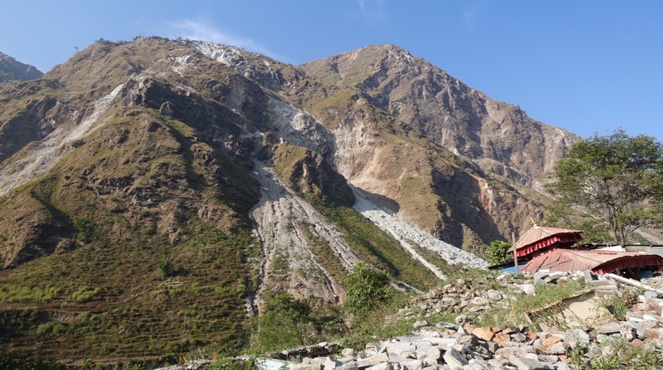
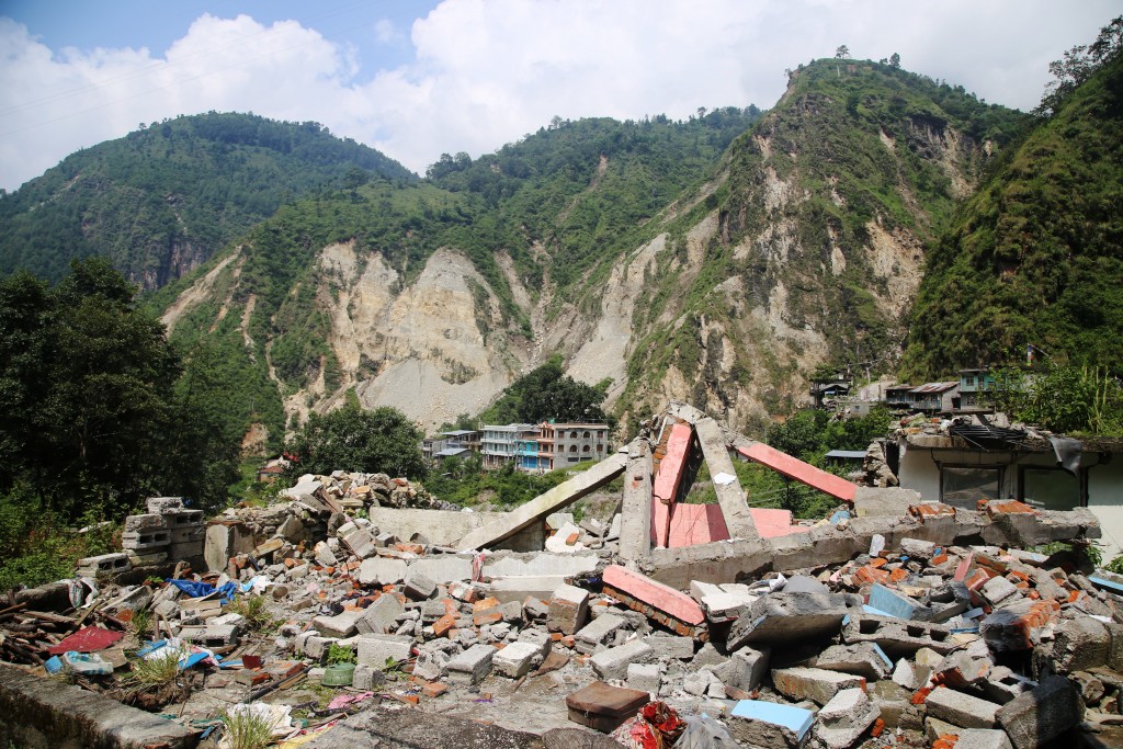
The 2015 Mw 7.8 Gorkha, Nepal Earthquake triggered in excess of 20,000 landslides across 14 districts of Central and Western Nepal. These landslides caused widespread damage to road networks, houses and settlements, in addition to key infrastructure including hydropower dams. The earthquakes and aftershocks also weakened and destabilized hillslopes, as illustrated by the many cracks that have formed and persist in cultivated hillsides. While Nepal has a well-established history of damaging landslides that are triggered by the annual monsoon, it is also important to recognise the scale, severity and legacy of the impacts of the Gorkha earthquake.
Experience in previous earthquakes (1999 Chi-Chi & 2008 Wenchuan, for example) shows that increased rates of landsliding are expected in Nepal not just in 2015, but for at least 5 to 10 years after the earthquake: this is therefore a medium-term problem. The duration of this disruption – the time needed for the landscape and risks to return to ‘normal’ background levels – is dependent on the legacy effects of the earthquake, rainfall and anthropogenic land-use practices. It is not currently possible to predict the exact duration or location of enhanced landsliding, but as time progresses it is possible to assess the pattern and rate of landsliding and to forecast its future development.
This UKRI-DFID SHEAR funded project therefore developed out of a need to map the development of landsliding in Nepal across the earthquake-affected districts, bringing together researchers, governmental bodies and NGOs to address what is a significant gap in our understanding of the evolution of post-seismic geohazards.
Project aims:
- To train and support a new in-country team of landslide mapping experts based at the National Society for Earthquake Technology (NSET), a Nepali NGO who as an institution are developing capacity in coseismic landslide risk assessment and management.
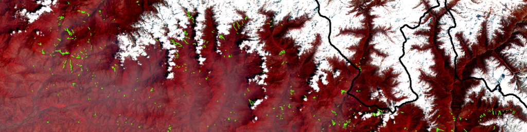
- To assess how the pattern of landsliding in the earthquake affected area evolved during the period from 2014 to 2020. This time window covers the pre-, co- and post-seismic periods, allowing the impact of the earthquake and subsequent monsoon seasons to be quantified. Two landslide inventories were mapped for each year (pre- and post-monsoon), as well as a separate coseismic inventory for 2015, resulting in a unique dataset totalling 14 multi-temporal landslide inventories.
- To use scenario-based landslide risk modelling to simulate earthquake-triggered landslide impacts on infrastructure in Nepal, to model monsoon impacts on current and future landsliding in Nepal, and to derive an assessment of risk based upon the mapped landslide inventories.
- To work closely with key stakeholders in Nepal to make our data widely available, and to explore how best this can be used to support the reconstruction effort and wider DRR agenda. Example stakeholder groups who have played a key role in the project include: the Government of Nepal (NRA, NDRRMA, MOHA, DSCWM, DMG), in-country NGOs (NSET, PiN) and independent Nepali landslide experts (e.g. Tribhuvan University).
The links below provide access to further information, maps, datasets and guidelines in Nepali and English. We also provide links to organisations and projects using these datasets below.
- For an English version of this website, please click here.
- यस वेबसाइटको अङ्ग्रेजी संस्करणको लागि, कृपया यहाँ क्लिक गर्नुहोस् ।
- For a Nepali version of this website, please click here.
- यस वेबसाइटको नेपाली संस्करणका लागि कृपया यहाँ क्लिक गर्नुहोस्।
Links
- Durable Solutions II
- BIPAD online disaster information management system
- NSET Nepal
- Durham University
- DFID-UKRI SHEAR
Any questions should be directed to Prof. Nick Rosser: [email protected]