Training Material

Training Material
Landslide mapping training workshop (August 2017)
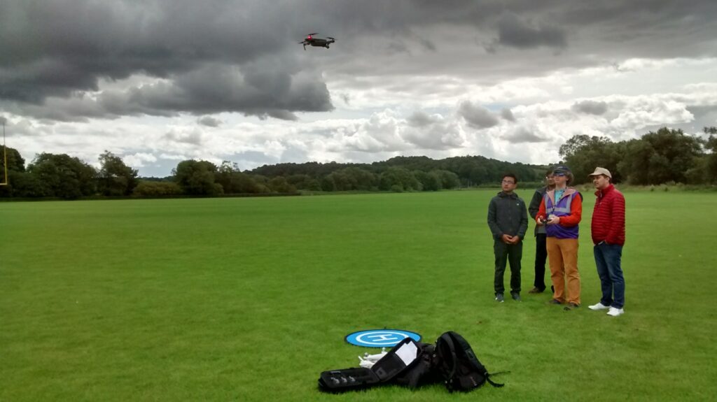
A week-long training workshop was held at Durham University, UK, in August 2017, involving staff from the National Society for Earthquake Technology, Nepal (NSET-Nepal). The workshop was focused on providing training on a range of techniques and approaches that were used as part of the DFID-funded landslide mapping project. This included practical experience of unmanned aerial vehicle (UAV) flying and subsequent data processing using structure-from-motion (SfM) photogrammetry, as well as the various satellite image datasets and methods involved in the GIS-based mapping of landslide inventories.
An outline of the workshop contents is provided below, along with links to download the material provided during each training session (Note: the full training package (~1 GB) can be downloaded here).
- Introductory Material
- Contents and itinerary (.pdf)
- UAV flight training
- UAV theory lecture (.pptx)
- UAV flying with Litchi (.pptx)
- Manuals and useful references
- UAV processing training
- Structure-from-motion (SfM) photogrammetry practical handout (.pdf)
- SfM practical data (.zip)
- Overview of landslide mapping
- Introduction to the project (.pptx)
- Landslide modelling (.pptx)
- Landslide inventories (.pptx)
- Overview of landslide mapping (.pptx)
- Handout: Downloading Landsat 8 imagery (.pdf)
- Handout: Downloading Sentinel-2 imagery (.pdf)
- Landslide mapping in QGIS
- QGIS installation guide (.pdf)
- QGIS basics (.pdf)
- Working with Landsat 8 imagery in QGIS (.pdf)
- Working with Sentinel-2 imagery in QGIS (.pdf)
- Mapping landslides in QGIS (.pdf)
- Sentinel-2 practical data (.zip)
- Mapping practice and practicalities
- Landslide attributes determined from satellite imagery (.pptx)
Digital elevation modelling workshop (January 2020)
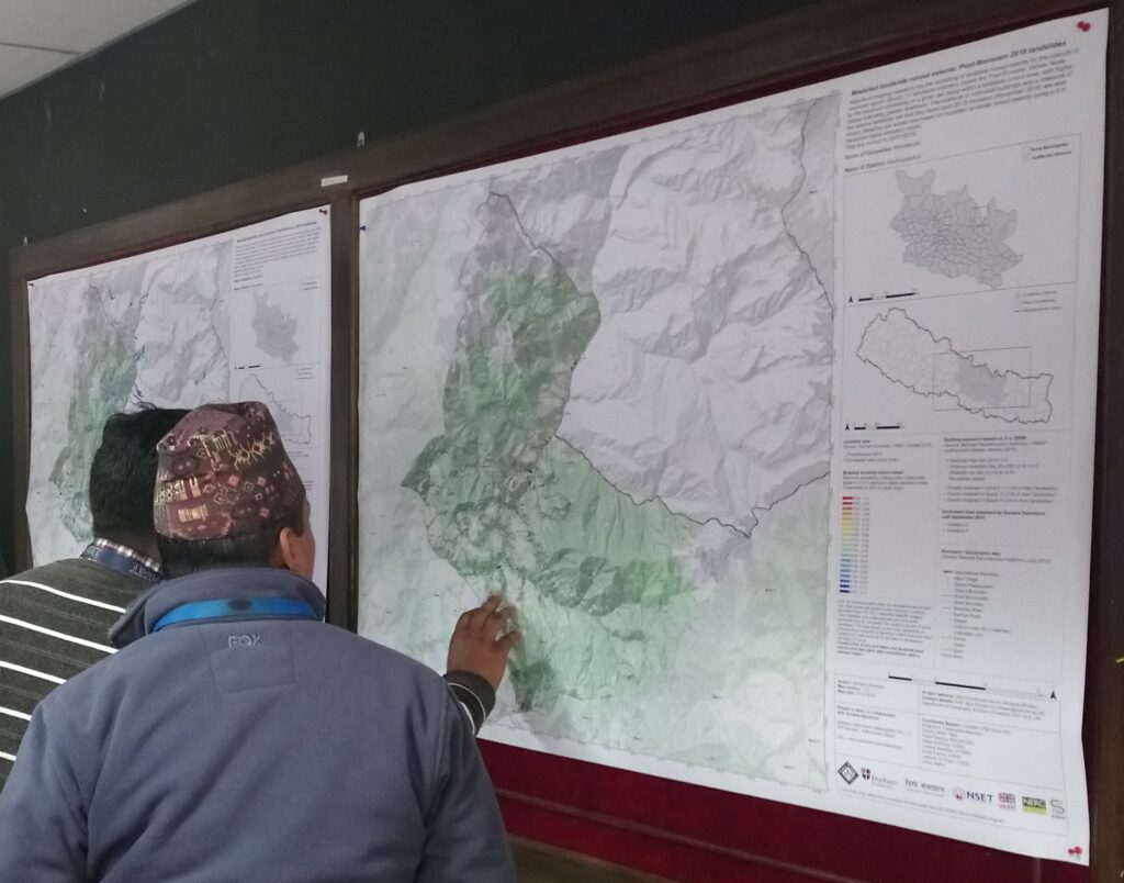
A training workshop was held at the National Society for Earthquake Technology (NSET) in Kathmandu, Nepal, in January 2020. The aim of the workshop was to provide an introduction to the 5 m resolution ALOS World 3D (AW3D) digital elevation model (DEM) data that was obtained as part of the DFID-funded landslide mapping project. Training sessions covered an explanation of the AW3D DEM data and how to use it for conducting a range of topographic and hydrological analyses, as well as case study presentations outlining how the data are being used for ongoing hazard-related research in Nepal. The workshop was attended by staff from a number of end-user organisations who have all been provided with licensed access to the AW3D DEM data as part of the project, including:
- National Reconstruction Authority, Government of Nepal
- National Society for Earthquake Technology (NSET-Nepal)
- Department of Mines and Geology, Government of Nepal
- Central Department of Geology, Tribhuvan University, Kathmandu
- United Nations Resident Coordinator Office (UNRCO)
An outline of the workshop contents is provided below, along with links to download the material provided during each training session (Note: the full training package (~300 MB) can be downloaded here).
- Introductory Material
- Case Studies